Further up the creek

It was finally time to take the snow tires off (fully realizing that we have had major snowstorms in May the past five years). So I went to one of the local tire places (yes, there are three right next to each other) and the one I chose is right next to the creek, just further up the stream. There didn’t used to be a trail until quite recently, but there was apparently lots of extra money in the city budget, so they extended the trail so that one can travel continuously along to downtown (if one wished to do this).

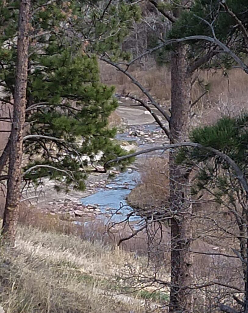
We’re just slightly further along from where we left off, and the creek is shallow and winding.

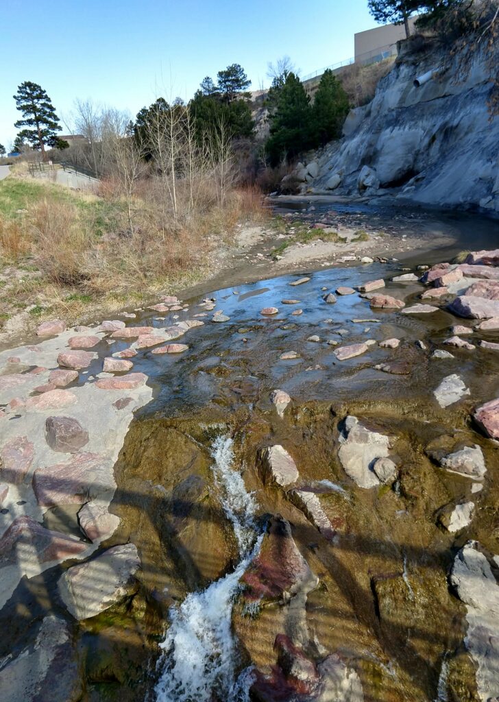
Looking upstream one can catch a glimpse of the strip mall that backs onto the creek. The shadow is cast by one of the many new bridges that cross the creek.

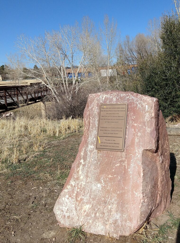
Here’s the commemorative plaque, which notes that “The land has always been here” until some family donated it to the the city, “for the pleasure and enjoyment of the community”. I’m not sure how the deer, bears and rabbits feels about this donation.

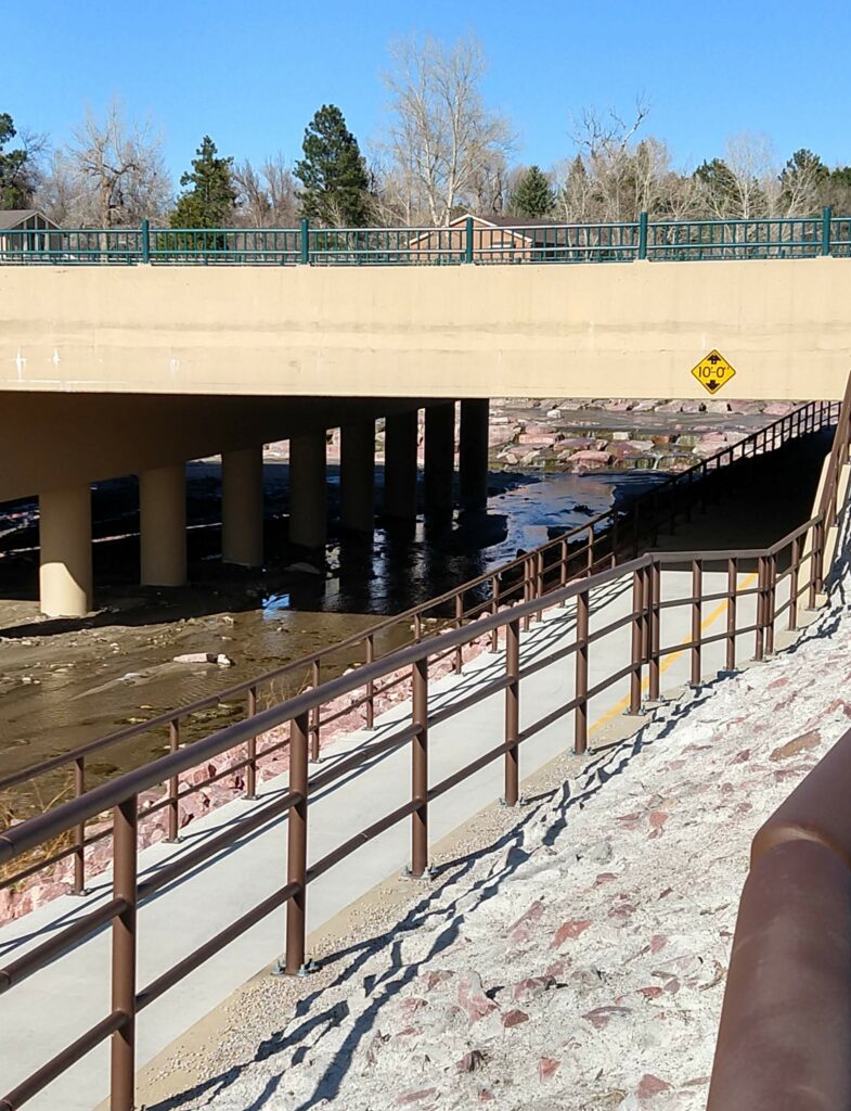
The new bridge goes over a major north-south street in our town (and it only took over a year to complete). It’s certainly an improvement to be able to get to the other side of the trail with impunity.

When I mentioned the creatures affected by the trail I did not include the raccoons. They left their muddy footprints here and are probably happy that the creekbed was cleared of debris so that it is easy for them to get to the water. They’re just another bit of nature carving out a living the the big city.

Up a Creek

As part of my continual exploration of my immediate neighborhood, today I wish to show bits of a nearby creek.

It’s not very impressive, but then again this is a semi-arid place. The larger stream is Monument Creek, and it runs through town from north to south. The puny waterflow is Cottonwood Creek, which ends here as it joins the larger stream.

It runs under the freeway, and on rare occasions it does flood. Once when me and Miss Dog were walking along this particular trail, we discovered wet bear tracks, and yet we kept on walking.

The creek also passes under this rather splendid railroad bridge. Years ago the railroad moved to the other side of Monument creek, but they left this bridge behind. On the upper far right is the new tunnel that allows one to bike along the trail that follows the creek. One can bike all the way to downtown, if one had a need to go downtown on a bicycle.

As the trees have not started to leaf out yet, the nests are on view. I don’t remember if this is a hawk’s nest or just home to those noisy corvid magpies.

This tree was probably modified by Ute indians. It looks like the sort of things that they created, possibly as a trail marker? Although one could just look up at the mountain to see where one is. These sorts of unique trees are found around the area, although the exact purpose remains a mystery.

Looking up along the creek gives the impression of a pastoral scene. At one time this was true, before there were houses, roads and a bike path, there were only cows and deer. But it is still a lovely bit of nature one can stroll along and admire on a pleasant sunny afternoon.

More Landscapes

It was a bit hard to select landscapes, I don’t typically photograph landscapes, although I could easily post 10 pictures of the mountain in all its glory. But, I rooted around in the various photos on my phone and came up with another batch that shows some of the places that I’ve been to, more or less recently.

This spot is along the Savannah River in a city park, I was visiting for a great-niece’s high school graduation. I was drawn to the Spanish moss hanging from the trees. It reminded me of when I lived in the south.

There is a high spot near Dallas, and this is it. (I see why Texans like to come to Colorado and New Mexico to look at mountains, they could really use one here.) Another niece was graduating from college.

I went to college in this town in New Mexico, and this is the oldest church there (started 1706, this building was put up in 1793 after the first one fell down.) It occupies a prime bit of tourist real estate now.

I was at M’s cousin’s house, standing on the front porch when I took this. It looks like it might be Mordor. Is it? Not really, but it is the original village site, they moved over to this side of the road when the railroad came through.

This is my favorite place to visit. That is the dome of St. Paul’s, being gradually hemmed in by all the new construction. 🙁

As a bonus I included this landscape painting (possibly from the Tate) taken because I like both cows and dogs. And it closes out the series with perhaps how a landscape was traditionally viewed (but it still might benefit from a pterodactyl or two). 😉

Landscapes

There are always those calls to post something on Facebook, like four things one has done, states or places one has visited, personal faults and confessions, etc. And like the chain letters of old, one is encouraged to keep it going. So far I have resisted the siren call of these things, but, for some reason (I am bored) I decided to follow the landscape challenge. I did not copy and paste the directions (I am not that much of a sheep, plus I am not sure how to do this ;-). But I did follow the directive to put the picture up, and to not say anything about where or what it was (that bit was easy). So here for your enjoyment are days 1-5.

This was from the very first batch of pictures taken with my latest phone. It is from a rather spectacular local city park.

This is my favorite village in northern New Mexico. I snapped this picture as we (me and M’s cousin) were barreling down the freeway. We weren’t going to stop and visit, so I am amazed that the picture came out at all, as we were going so fast.

I took this in August, 2018 of the old steel mill south of here, and I took the picture to prove that any picture is made better when one adds a pterodactyl.

And it was a perfect post for April Fools Day.

This picture is from last summer. I was at the last rest stop before the New Mexico border. One has to go up and over the pass to reach this next state.

This is an old picture that I think I took with my first digital camera. I was born in this city, just south of the downtown area. I do pre-date the Arch by some years. I was driving around taking pictures and was at the stoplight at 14th and Jefferson by the Federal courthouse.

So now you know, dear reader, the what and where of my landscapes.

Another Day

Just north of the hoodoos, and across the street, there used to be a bit of waste ground. This was so long ago that we used to walk Mr. Dog (the predecessor of Miss Dog) there to let him run free. Now there are office buildings and paved parking lots in this area, but I decided to take a walk there (no chance of running into other people).

And lo and behold, there were some baby hoodoos there (just like the one’s they destroyed across the street). Well this looks promising.

At the north end of this area there is a little creek that marks the boundary of development. There was water flowing in this because it had snowed just that morning. When they put in the buildings they took down the old train bridge that went across this, so this is as far as one can go. There is still waste ground to the north, and part of this is owned by the Air Force, I think.

The western edge of the property also has a little ephemeral stream running along it. One can see the thin seam of coal in it too. Just beyond this is the freeway (motorway). Traffic was not very heavy, but it is still plenty noisy.

I believe I might have mentioned (once or twice, anyway) how much I love reflections. And here on this rather ordinary office building was a perfect reflection of our lovely mountain.

This is progress I suppose, but they can’t eradicate every trace of what was there before (at least not yet).